


As the sweltering summer continues to blanket Florida, weather conditions are shifting. Scattered storms are making a return across Central Florida, especially on Monday afternoon, with the highest chances of rain occurring west of Orlando along the I-75 corridor. While residents may hope for relief from the heat, the forecast indicates it’s not going to be that simple. High temperatures are expected to climb into the low to mid-90s, and by mid-week, we could see the mercury reaching the mid- to upper 90s. Even the heat index could threaten a staggering 110 degrees, undoubtedly prompting concerns about heat safety in our communities. Click Orlando reports that lower storm chances are likely through the middle of the work week, but the heat will remain unyielding.
Meanwhile, speculation for tropical activity is heating up. Invest 97L is gaining attention as it churns near the Cabo Verde Islands, with substantial chances for development in the next 48 hours. There’s chatter that this system may be on its way to becoming the year’s first hurricane as it navigates west-northwest through the Central Atlantic. Historical data suggests that hurricanes typically gain momentum during this time, especially given that the average first hurricane forms right around August 11. It’s an important date for Floridians to remember, as AccuWeather reminds us that water temperatures from Africa all the way to the Gulf Coast are sitting at or above 80 degrees—perfect for tropical systems to blossom.
Potential Storm Developments
As reported by FL Hurricane, the latest updates from Invest 97L predict that it could officially be designated as a tropical depression shortly. This speculation comes from tracking data showing that the system is currently hovering over the Cabo Verde Islands. Over the next day or so, 97L may encounter less favorable conditions, such as cooler waters. This could slow down its intensification, but there are indications that it could evolve into a significant hurricane if it reaches warmer waters further west. If it does become a named storm, it will take on the title of Erin, adding to Florida’s already intense hurricane season.

What’s more, there is a separate area of low pressure in the eastern Gulf that could potentially develop before making landfall in North Florida next week. While not officially tagged as an „Invest,“ some models indicate we might see a depression forming soon. Regardless of its naming rights, significant rainfall is anticipated for the region as this system approaches.
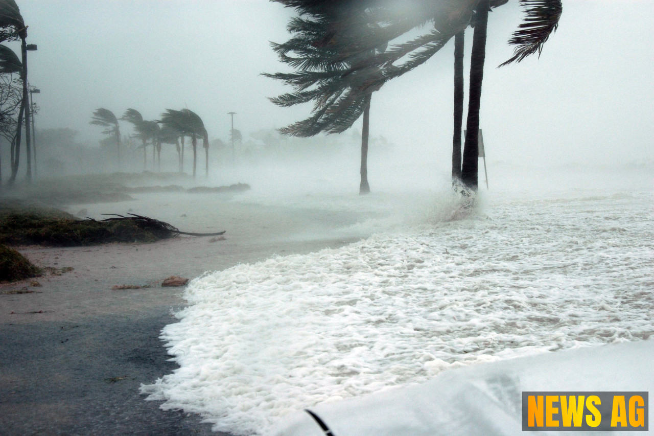
Understanding the Risks
Historically, about 30 major hurricanes have influenced the U.S. during August over the past 175 years, with the Gulf often feeling the brunt of these storms. The peak of hurricane activity typically runs from mid-August to mid-October, and recent trends indicate that increased activity could be on the horizon this month, keeping local residents on high alert. For those watching the tropics, the National Hurricane Center does not anticipate any severe tropical threats in the coming week, though heavy rains are still predicted across the southeastern and Gulf Coast regions. So while the coastal areas brace for potential downpours, residents inland should remain aware of the soaring heat index and moisture levels.
As we approach the end of summer, one thing is sure: Florida weather is as unpredictable as ever, and vigilance is key as we navigate these sweltering days filled with the possibility of storms. Stay tuned to reliable sources like Click Orlando, USA Today, and FL Hurricane for continuous updates and safety information as we move deeper into this critical season.