


As summer gives way to fall, Florida is bracing for some weather changes, while also reflecting on a historical hurricane that reshaped the Gulf Coast twenty years ago. Today, we report on the current weather outlook, the potential for a new tropical disturbance, and a remembrance of Hurricane Katrina, a storm that highlighted the immense power of nature.
The forecast for the rest of the week looks like a classic Florida summer pattern, filled with both sun and storms. A stalled front to the north is ushering in moisture which could lead to scattered rain and storms, especially as we approach the weekend. According to MyNews13, Saturday is set to start off sunny with temperatures climbing into the upper 80s to lower 90s, but expect scattered rain popping up by mid-afternoon. We could see heavy rain, frequent lightning, and gusty winds rolling in by Sunday, just in time for Labor Day plans, with highs around 90°F and lows in the low to mid-70s.
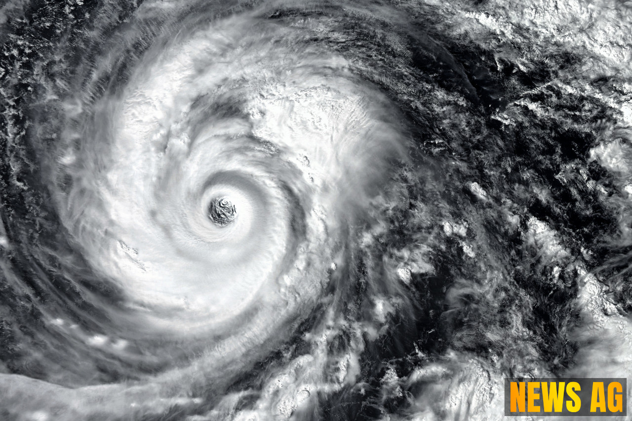
A Potential New Tropical Wave
Adding to the buzz around current weather conditions, meteorologists are keeping an eye on a tropical wave forming off the west African coast. It’s projected to move south of the Cape Verde Islands, with some potential for development. This situation contrasts sharply with the memories of storms past, particularly Hurricane Katrina, which became a devastating force just a few days later in 2005.

Hurricane Katrina first emerged as Tropical Depression Twelve on August 23, 2005. The storm quickly intensified, becoming a hurricane just before making landfall in Southern Florida on August 25, as noted by CBS News. Though it weakened soon after, it regained strength and became a Category 3 hurricane when it struck Louisiana on August 29, causing catastrophic damage and over 1,300 fatalities. Katrina illustrated just how a hurricane can rapidly intensify, with maximum sustained winds reaching a terrifying 173 mph before making landfall.
Florida’s Hurricane History
The impacts of hurricanes in Florida’s history cannot be overstated. As detailed by Florida State University’s Climate Center, hurricane season spans from June 1 to November 30, peaking between mid-August and late October. Notably, every part of Florida’s coastline has faced hurricane impacts since 1850, but areas like the southeast coast and the panhandle suffer more frequent direct strikes. This reality makes awareness of hurricane categories and potential impacts critical for residents.
The Saffir-Simpson Hurricane Scale, which classes hurricanes based on wind speed, has been a vital tool for understanding potential destruction. With winds upwards of 156 mph categorized as a Category 5 hurricane, the destructive capability is daunting. However, it’s important to remember that nearly 90% of hurricane-related deaths are attributed to flooding from storm surges, underscoring the danger of complacency.
As we remember Hurricane Katrina and brace for changing weather patterns, it serves as a reminder to be prepared for whatever nature might throw our way. Residents are urged to stay informed, know their evacuation routes, and remain vigilant as the season progresses. Whether it’s a weekend stroll during sunny intervals or a thoughtful pause for those lost in past storms, let’s navigate this hurricane season with care and consideration.
Whether you’re casting your line from a pier, heading to a local market, or simply enjoying the great outdoors, remember that a little preparation can go a long way in keeping us safe during these stormy months ahead.