


As Florida embraces another summer day on July 17, 2025, humid air continues to blanket the region, promising a mix of spotty showers and warmer temperatures as the day unfolds. According to WTXL, residents in Tallahassee can expect highs in the low 90s as morning showers give way to more scattered rainfall in the afternoon. Although these brief downpours may provide a temporary relief from the heat, they also come with a risk of heavy rain and lightning, prompting locals to find shelter when the skies darken.
Weather patterns are influenced by a southerly wind, drawing in moisture from the Gulf, which makes for rather muggy conditions as summer rolls on. For many, these sticky, hot days are a reminder that summer is at its peak. In fact, from Friday onward, the forecast hints at a shift toward classic summer vibes, with soaring temperatures in the upper 90s and a decrease in rain chances, giving Floridians something to look forward to.
Invest 93L: A Watchful Eye
Out in the Gulf, tropical activity is heating up with Invest 93L slowly churning across Florida. As reported by USA Today and echoed by the Palm Beach Post, this tropical rainstorm is making headlines as it has the potential to strengthen into a depression near Louisiana later this week.

As of 2 p.m. on July 16, Invest 93L was reported near Panama City, bringing disorganized showers and thunderstorms, primarily affecting areas to the south and southwest of its center. The forecast indicates that this system is likely to continue its westward trajectory, making its way toward the Louisiana coast by Thursday. There’s a fair chance of development; forecasters assign a medium formation chance of 40% within the next two days, which is echoed for a week ahead.
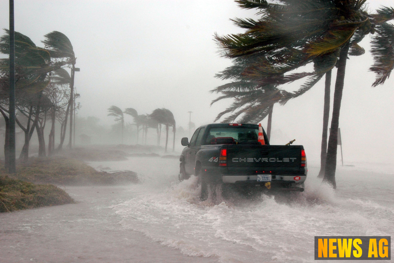
Precautionary Measures
Residents are advised to remain vigilant as heavy rainfall is expected to persist in various regions throughout Florida due to this system. With localized flash flooding on the cards, it’s prudent for everyone to keep a close eye on the weather reports. The National Hurricane Center is actively monitoring Invest 93L, reflecting the critical role of timely meteorological updates in keeping communities informed during hurricane season.
As the peak of the Atlantic hurricane season stretches from June 1 to November 30—historically accounting for 97% of tropical cyclone activity—the next named storm, expected to be Dexter, could arrive soon. Historical averages suggest that the fourth named storm typically makes an appearance around August 15, so all eyes remain on the horizon.
In conclusion, while summer in Florida often means sunshine and beach fun, it is essential to stay aware of weather developments and take precautions as storms brew in the Gulf. The blend of high temperatures, humidity, and the potential for severe weather serves as a compelling reminder to be prepared and stay alert this hurricane season.