
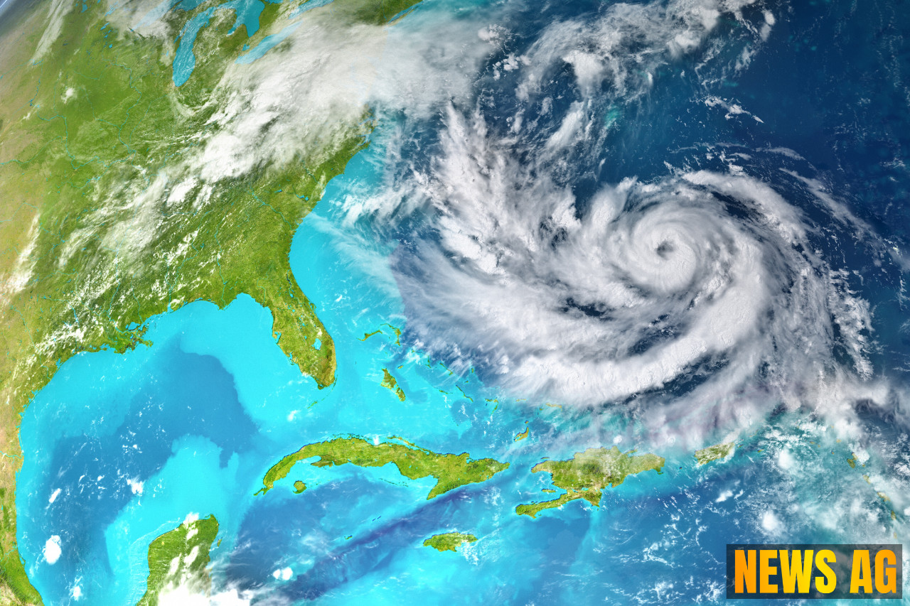


As of July 7, 2025, the Atlantic hurricane season is shaping up to be quite eventful. The latest named storm, Tropical Storm Chantal, has now weakened to a post-tropical cyclone following its landfall in South Carolina on July 6. Currently, Chantal is positioned over the Delmarva Peninsula and is drifting northeast. With maximum sustained winds hovering around 30 mph, little change in strength is anticipated in the coming days, according to the Herald-Tribune.
Chantal’s passing leaves behind a trail of heavy rainfall, with predictions of 1 to 3 inches expected to drench areas including Virginia, Maryland, Delaware, New Jersey, and Pennsylvania. Flash flood watches are in effect across these regions, stressing the need for caution. Furthermore, life-threatening surf and rip current conditions are expected along the U.S. East Coast from northeastern Florida to the Mid-Atlantic states as the storm continues its journey.
What’s Next? Meet Dexter
As we look ahead, the next named storm to enter the forecast is set to be Dexter, which has now replaced Dorian on the Atlantic hurricane list due to Dorian’s destructive rampage in 2019. It’s important to note that 2025 is already being marked as a wild season, given that the first named storm, Tropical Storm Andrea, didn’t form until June 24. This unusual start to the season is the latest since 2014, as highlighted by statistics from Wikipedia.

The current predictions for the 2025 hurricane season suggest an average of 14 to 19 named storms, with 6 to 10 hurricanes, as various forecasts work through their predictions. As of now, the season has seen three tropical cyclones form, all of which have become named storms. Chantal’s journey, while short-lived, was noteworthy, with peak intensities reaching 60 mph. In comparison, Tropical Storm Andrea stirred up peak winds of around 40 mph while Tropical Storm Barry, which formed shortly after Andrea, peaked at 45 mph.
A Look at Recent Activity
The early months of the hurricane season have already caused notable damage. Tropical Storm Barry left its mark in Quintana Roo, Mexico, with damages estimated at Mex$35 million (around US$1.87 million), and Chantal caused significant flooding in North Carolina. The state of emergency declared in Orange County saw over 50 water rescues due to the relentless rains, making it clear that the storms are capable of inflicting substantial impacts.
In terms of storm patterns, NOAA has indicated that warm ocean temperatures and weak wind shear could result in an above-normal hurricane season. This has the potential to set the stage for more frequent tropical activity as the season progresses, considering the average Atlantic hurricane season features an estimated 14 named storms, 7 hurricanes, and 3 major hurricanes since 1991.
While the early activation of the season often raises concerns, strides in preparedness and response can mitigate damages. Residents are encouraged to stay vigilant and be ready for any developing storms as this hurricane season continues to unfold. It’s wise to have plans in place and remain informed as the National Hurricane Center keeps a watchful eye on ongoing developments.