


As residents of Florida prepare for the weekend, the weather forecast brings a mixture of anticipation and caution. Today marks a significant date—August 29, 2025—a day that compels us to look back on past storms while keeping an eye on tropical developments. According to mynews13.com, a stalled front to the north is causing increased moisture, leading to storms in the area. Saturday is expected to start off sunny, with temperatures climbing into the upper 80s to lower 90s. However, by mid-afternoon, scattered rain and storms are predicted, bringing potential for heavy rain, lightning, and gusty winds.
Sunday’s outlook offers little reprieve, with early storms anticipated and a high probability of rain on Labor Day. High temperatures are projected around 90°F, while lows will settle in the low to mid-70s, with about 60% rain coverage expected.
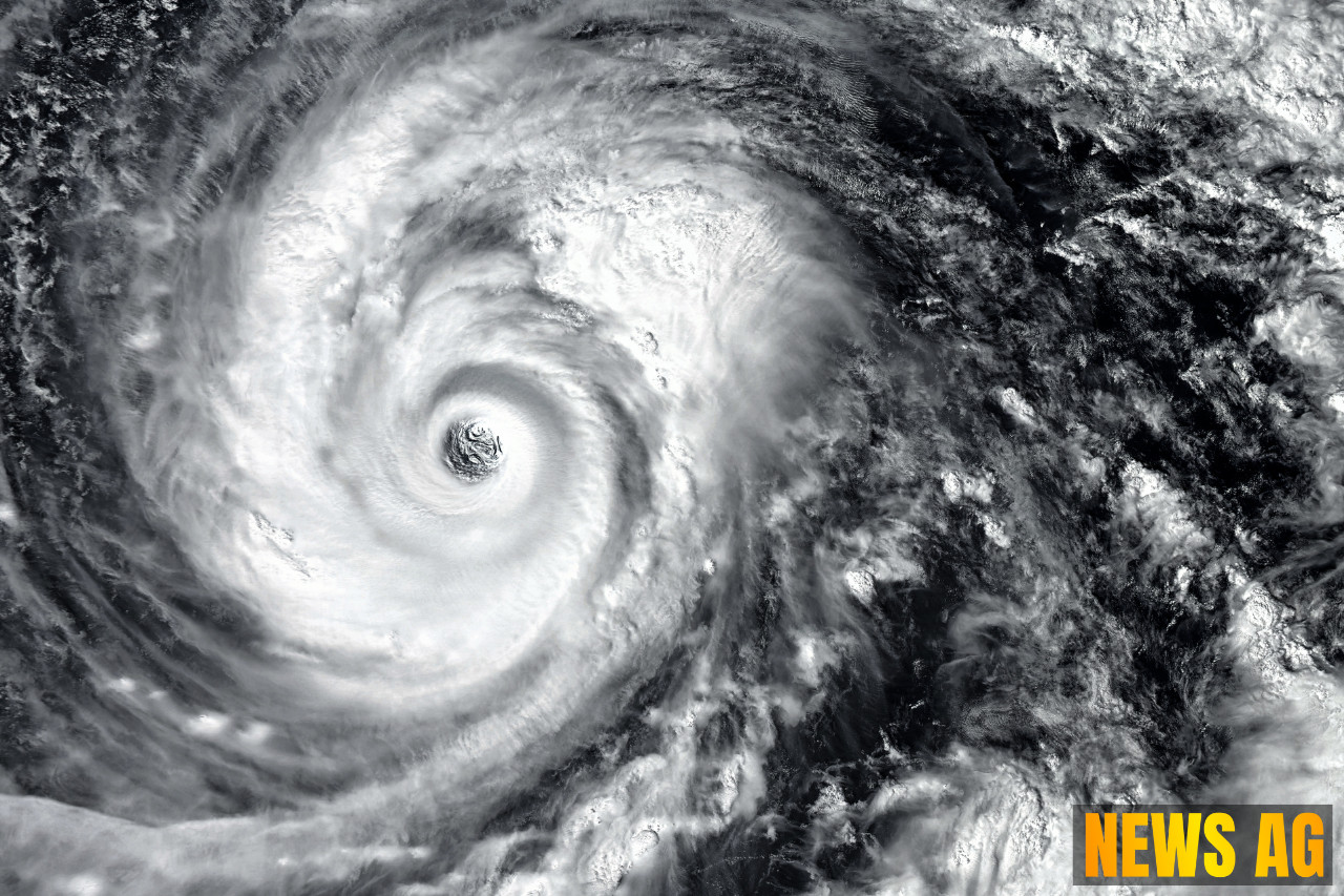
A Reflection on Hurricane Katrina
This day also resonates with another significant landmark: the 20th anniversary of Hurricane Katrina, which drastically altered lives and landscapes. CBS News chronicles how Katrina developed initially as Tropical Depression Twelve on August 23, 2005. Moving swiftly, it intensified into a hurricane by August 25, just hours before making landfall in Southern Florida. The storm ultimately wreaked havoc across the Gulf Coast, leading to catastrophic flooding, particularly in New Orleans, where around 80% of the city was inundated.

Katrina’s legacy still lingers in the hearts and minds of many Floridians. The storm is remembered not just for its force—recording winds up to 173 mph—but also for the tragic human toll of 1,392 fatalities and damage estimated at $125 billion, rendering it the costliest hurricane in U.S. history. For those of us in the state, the memory serves as a poignant reminder of both nature’s potential ferocity and the importance of preparedness.
Continued Vigilance: Tropical Update
Moving forward, there’s more to monitor. The latest tropical update reveals a wave emerging off the west coast of Africa, approaching the Cape Verde Islands with a chance for slow development. While it may be too early to predict its path or intensity, the uncertainty highlights the importance of staying informed, particularly during peak hurricane season, which runs from June 1 to November 30.The Florida Climate Center notes that all areas of Florida’s coastline have been impacted by hurricanes since 1850, urging residents to remain vigilant, particularly as memories of past storms linger.
As we navigate through this transitional weather and pay homage to a storm that left its mark on our history, let us also unite in our commitment to preparedness. Knowing evacuation zones and property elevations, as well as understanding the risks associated with hurricanes, are crucial to safeguarding lives and homes. With this in mind, it is not just about facing the storm but also about standing resilient against whatever may come next.
In the meantime, community events like the Mid-Florida Milers Orlando North Walk and the Super Shark Tour at SeaLife Aquarium serve as delightful distractions. For those looking to explore global crafts, the Oviedo World Market will also be held today. Let’s not forget that amidst the anticipation of weather changes and reflections on past storms, there’s plenty to enjoy in our vibrant communities.