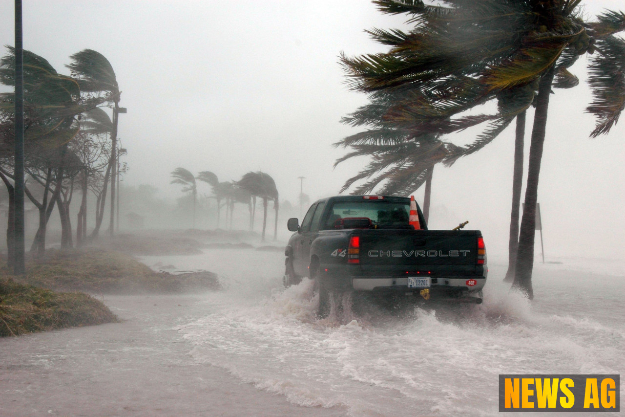
As the sun rises over Boca Raton, the threat of heavy rain looms large over South Florida. The region finds itself under a warning, with the National Weather Service indicating a slow-moving area of low pressure combined with a frontal boundary over northern Florida. This combination is set to unleash a deluge that could see some areas receiving as much as 10 inches of rain through Monday. With this in mind, residents are encouraged to stay vigilant and keep an eye on the latest forecasts.
Boca Raton and surrounding areas can expect widespread rainfall totals that could reach 4 inches, while isolated pockets may be even worse off, experiencing 6 to 10 inches or more. These heavier deluges are not just a number on a weather report; they carry the real risk of urban and flash flooding, particularly in low-lying areas that have struggled with drainage issues in the past. In wake of the stormy forecast, local residents are reminded to avoid driving through flooded streets and to keep informed through outlets like the National Weather Service, which can be accessed at weather.gov/mfl.
Understanding the Risks
Flooding is no stranger to South Florida, and this current threat continues a long history of water-related disasters in the region. To understand what could be at stake, one doesn’t need to look far back—the state’s landscape has been shaped by various catastrophic events, including the infamous hurricane of September 16, 1928. This devastating storm made landfall between Jupiter and Boca Raton, wreaking havoc and resulting in significant loss of life and property.
Reports indicate that the storm caused flooding over a vast area, with water levels rising to over 20 feet in some regions. The aftermath was grim, with thousands losing their lives. Floodwaters lingered for weeks, complicating recovery efforts. Since that time, improvements have been made, with significant flood control measures instituted, including the Herbert Hoover Dike and various drainage systems designed to mitigate future risks.
Staying Informed
In modern times, advancements in weather tracking and communication have made it easier for residents to prepare for storms. The National Weather Service offers detailed radar and alerts that provide critical information about approaching weather conditions. For instance, the NWS Radar site allows for real-time updates on rainfall, storms, and local hazards, making it an essential tool for anyone looking to stay safe during severe weather. For those who prefer mobile updates, handy bookmarks can turn complex weather tracking into a user-friendly experience, much like having your personal weather app.
While current forecasts paint a concerning picture, understanding the history of flooding and utilizing available resources can help residents prepare effectively for the challenges ahead. It’s a call to action for the community to remain informed, connected, and ready to respond to any potential flooding that may arise from the predicted rains.
As we brace for what may come, the words of local forecasters remind us: being informed is not just a precaution but a necessity in these turbulent times. Stay safe, Boca Raton, and keep an eye on updates from National Weather Service Radar and local news channels. After all, when it comes to weather, a little preparation does a good deal!