
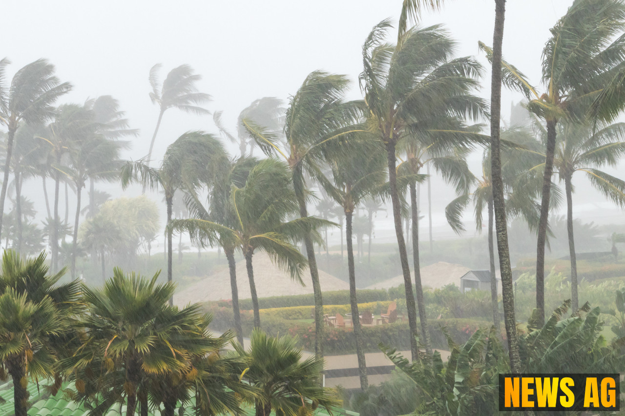


As the Fourth of July approaches, Floridians are bracing for a potential disturbance in the weather, with a low-pressure system developing that could bring substantial rainfall over the holiday weekend. The National Hurricane Center (NHC) has issued warnings indicating that this area of low pressure could evolve into a tropical or subtropical depression within the next few days, although it’s still too early to predict its exact path and intensity. Experts emphasize that conditions are moderately favorable for this development, with a significant probability of rain looming over Florida’s west-central and central areas.
Currently, the chances of this low-pressure system developing into a more serious weather event stand at 60% over the next week, with a 20% increase likely in the next 48 hours. If the system indeed intensifies, forecasts suggest potential rainfall totals could reach between 2 to 6 inches, causing concerns for local flooding as many residents prepare for outdoor celebrations. The impact of this weather pattern isn’t just about rain; it might disrupt fireworks displays and parades that are beloved traditions during Independence Day festivities.
Rainfall Predictions and Precautions
According to La Prensa Orlando, heavy rain is expected from July 4 through July 6, with forecasts indicating that rainfall could cover as much as 60% to 80% of the region. Areas such as Pinellas, Hillsborough, Pasco, Manatee, Sarasota, Polk, Charlotte, Lee, and DeSoto counties are on alert for the anticipated severe weather, with FEMA urging residents to stay informed and prepared for possible emergencies associated with flooding and storm surges.

The ramifications of flooding can be severe, as warned by FEMA, with implications of contaminated waters potentially posing health risks that the public needs to be aware of. For avoidance of danger, residents in susceptible areas are encouraged to monitor updates from the NHC and follow local guidance closely.
The Bigger Picture
The current weather situation comes in the context of the Atlantic hurricane season, which runs until November 30, and is known for heightening activity during July. This period often serves as a precursor to the rest of the storm season, which peaks around mid-September. Meanwhile, the NHC is also tracking several other tropical waves and the named storm, Chantal, which recently formed, hinting at a busy season ahead.
In conjunction with these warnings, experts note that the system’s final trajectory may be influenced by two high-pressure systems situated in nearby areas. While there is no definitive timeline for when the storm will conclude, it is essential to remain vigilant as meteorologists predict continuous monitoring of the Atlantic for any additional developments in the coming days.
As we gear up to celebrate Independence Day, it’s crucial for Floridians to prepare for the changing weather and to keep a close eye on updated forecasts. Gather those umbrellas and have a plan ready just in case Mother Nature throws a curveball this holiday weekend!
For more details about the developing weather situation, visit La Prensa Orlando, Herald USA, and Ocala.com.